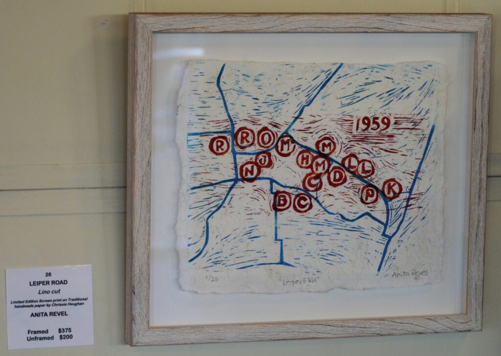
Cowaramup artist celebrates Scottish history with “Leiper’s Road” limited edition print
Artist Statement
Scottish born Robert (Bob) Bruce Leiper, first settled in Cowaramup in 1932 during the Depression. He came via Esperance, and brought with him, wife Marion (Dempster), and 6-month-old son, William Edward (Bill) Leiper. Bill learned first-hand from his father, how to be of service to the community.
Bill said of his father:
“He had a great desire to help people, particularly group settlers walking off properties. He helped them get loans, and getting others onto sustenance. He should have been a lawyer!”
Together with his wife Marian, Bill was the lynchpin in bringing power from just north of the Cowaramup township, across-country and along Leiper’s Road (now Miamup Road), Harman’s Mill Road (now Tom Cullity Drive), and through to Caves Road.
“We had to recruit two farms per mile to be eligible for power. Marian typed up all the letters to the farmers explaining the situation, which she didn’t enjoy much…”
(“I didn’t marry a farmer to be an office girl!” says Marian.)
“We were the only family on Leiper’s Road with a phone. It was installed during the war, and the wire was strung from tree to tree all the way to town. Our phone number was 205. The farmers offered me 15 shillings each to cover our costs but I wasn’t interested.”
The power poles were made from bush poles sourced and processed from the farmers’ own properties, and installed by the farmers using a Fordson tractor and volunteers. The power was eventually turned on in 1959.
“It cost us 240 quid to connect the power from the pole to our house and sheds. Some of the families didn’t have two bob to jingle on a tombstone so we all pitched in an extra 10 quid to get them connected.”
Bill and Marian celebrated by selling their generator at the next heifer sale in March ’59.
My print represents a map of the farmers who were a part of this power roll-out, stretching along Leiper’s Road to Caves Road. Some farms are still owned and operated by the original families today, including the Leiper family which is now a fourth-generation farm.
The families depicted on this map are (from left to right): Reynolds, Robinson, Nelson, Juniper, Osborne, McLeary, Beswick, Hick (now the location of Howard Park), Clews, Creedon, Mitchell, Maylam, Dempster, Leiper (Bill and Marian), Leiper (Bob and Marion), Percy, Kelly.
